Synthesis Maps are a great way to get started with the Navigator.
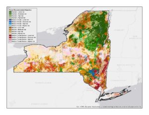
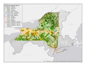
Recommendations Maps: One of the Navigator’s key features are the Recommendation Maps that suggest what conservation objectives to pursue for forests and streams across the state, as well as their likelihood of success in light of climate change risk. View them below as static maps.
Forests Streams
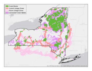
Connectivity Map: This map shows priority areas to support connections among forested habitats. Large unfragmented forests, least-cost linkages between them, and a well-connected landscape are all part of an important connected network.